12 000 CZK
| 480 EUR
Lot 107
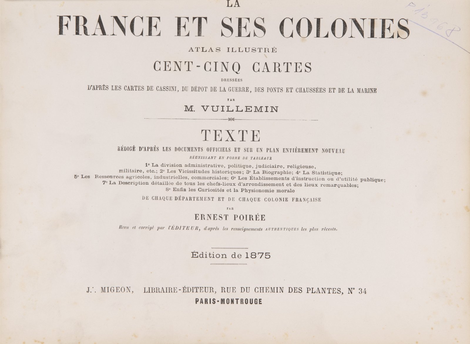
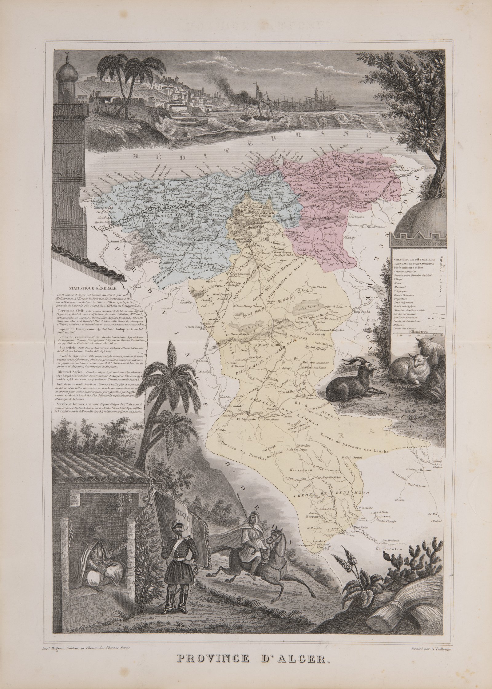
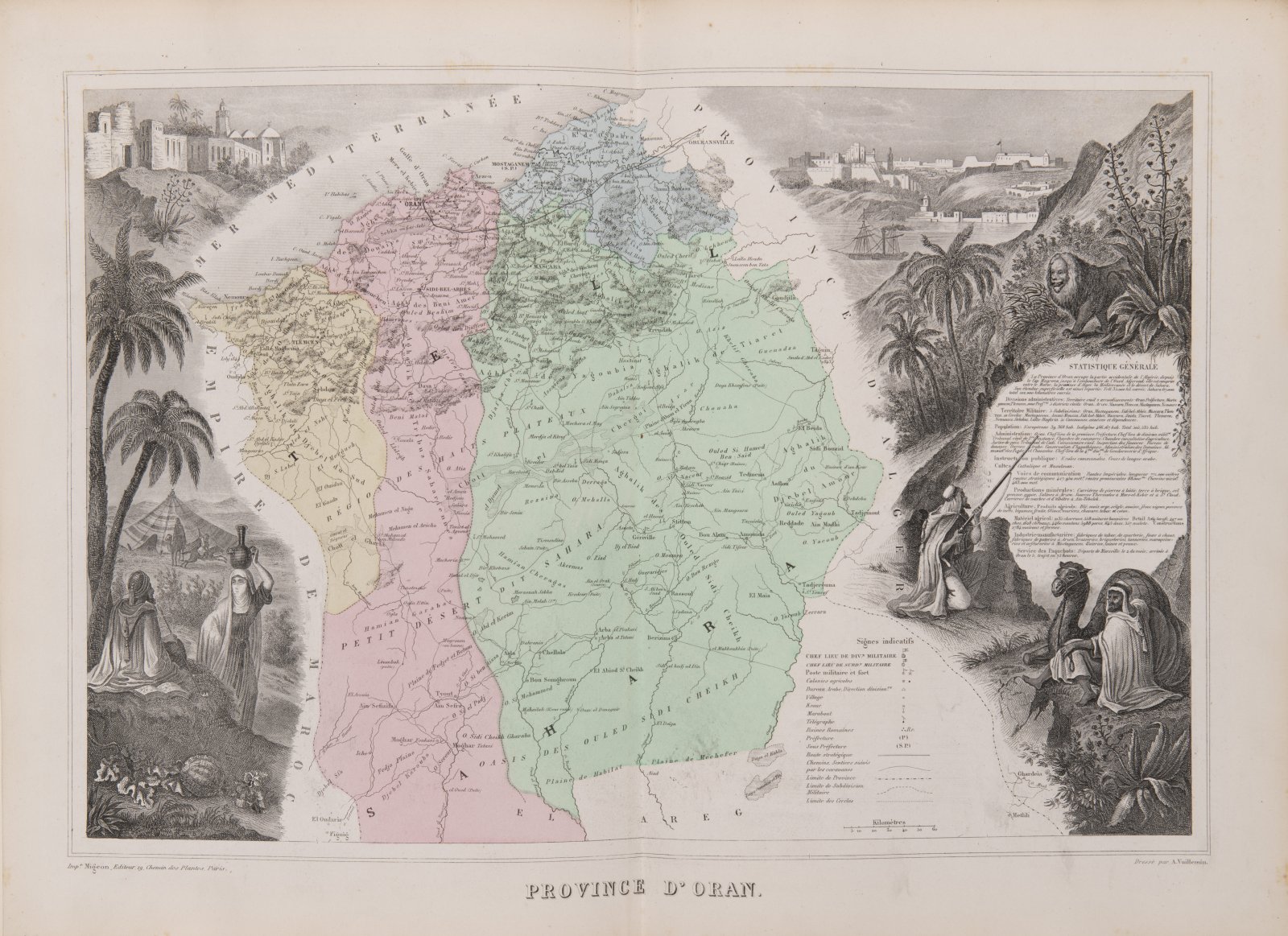
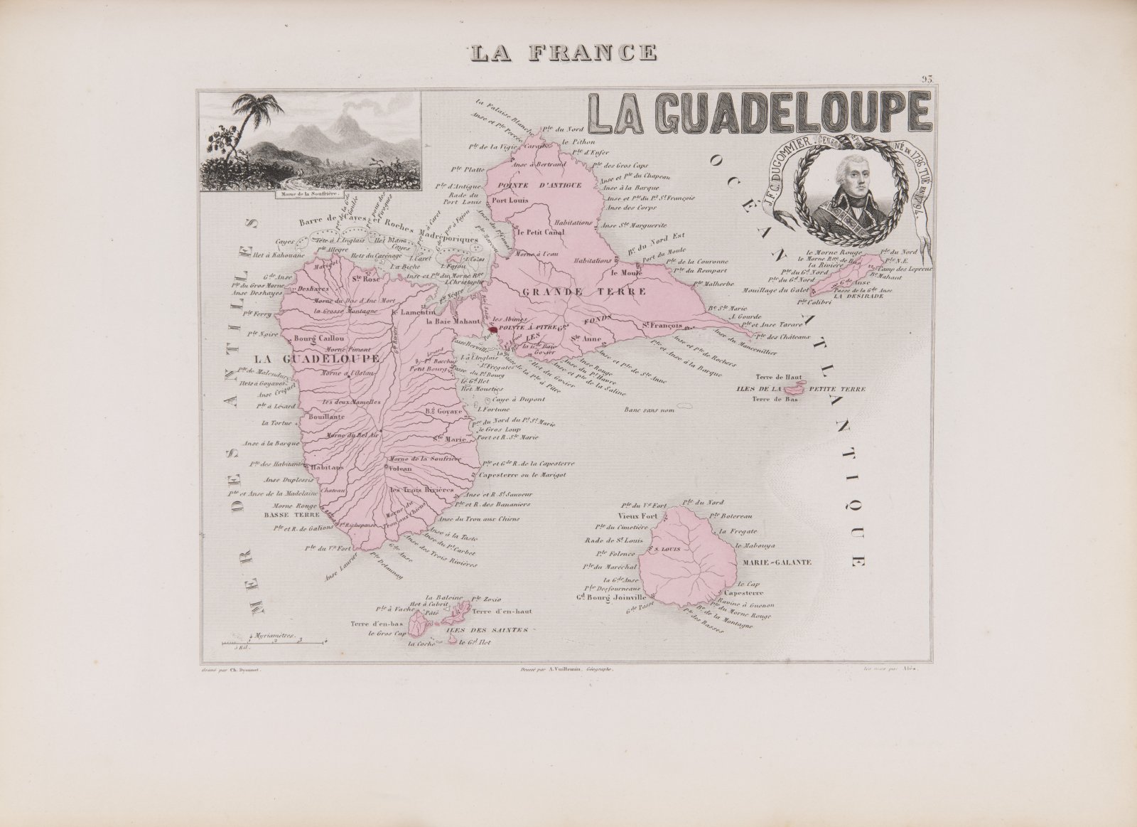
GEOGRAPHICAL ATLAS FRANCE
1875
36 x 26 x 5 cm (h x b x t)
Rufpreis
Erzielter Preis
12 000 CZK
| 480 EUR
| 480 EUR
preis ohne Aufpreis
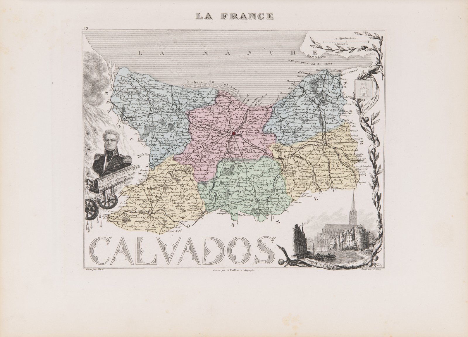
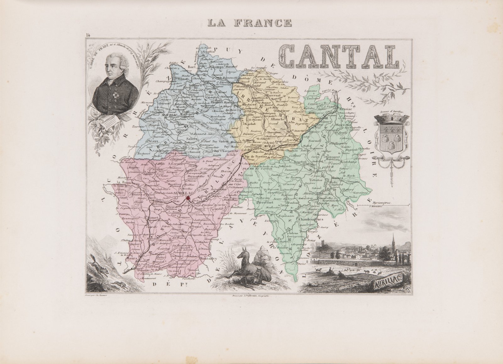
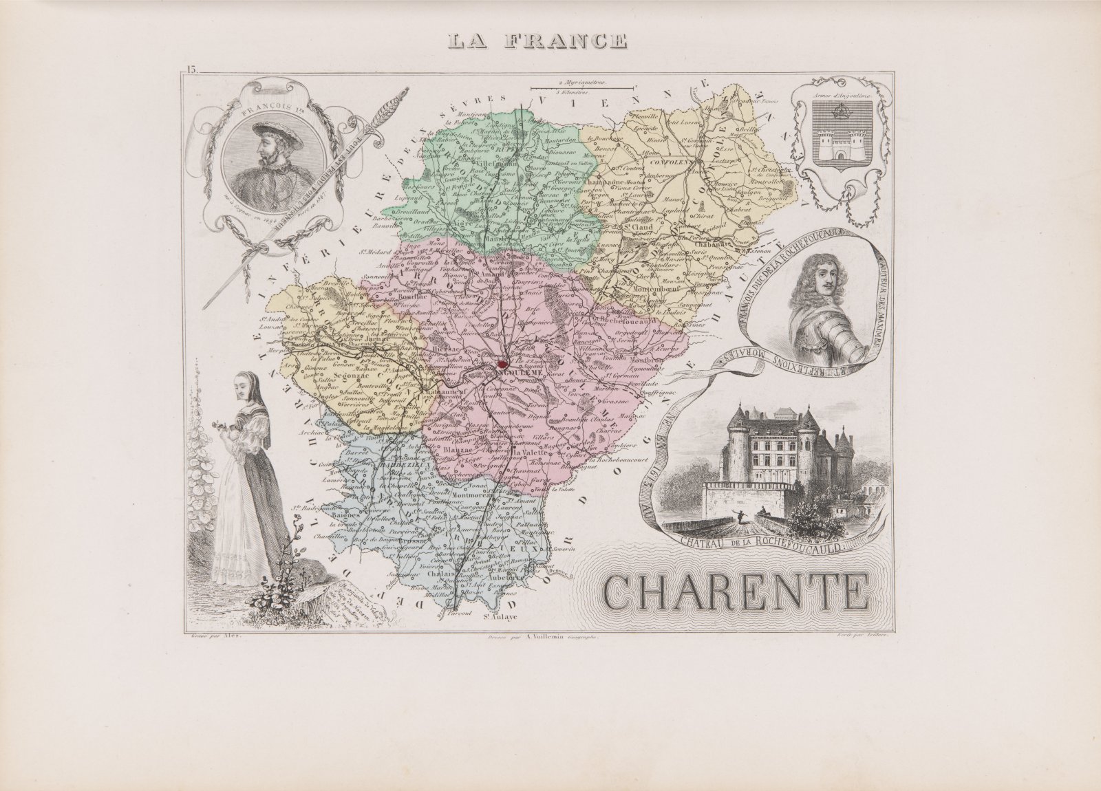
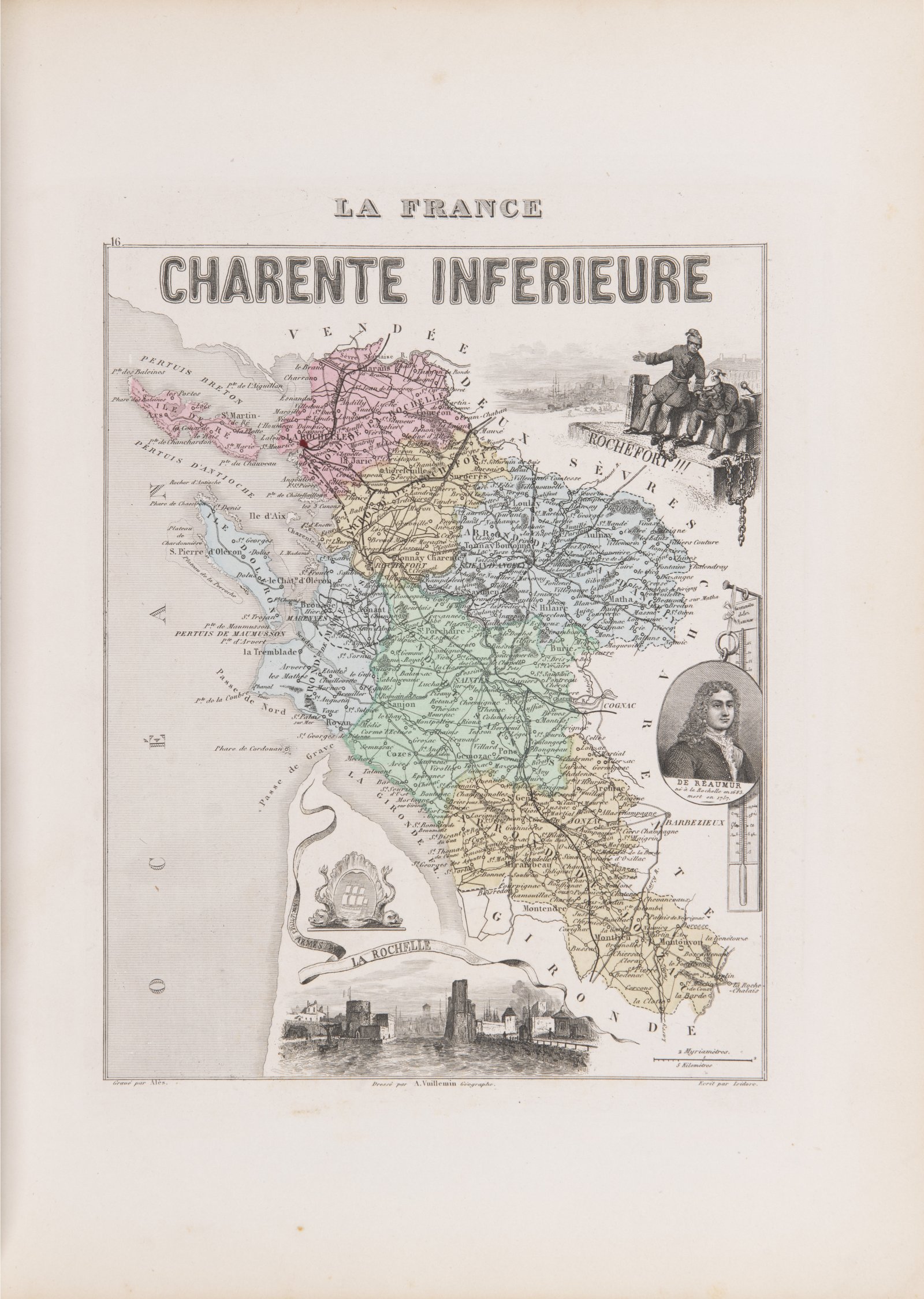
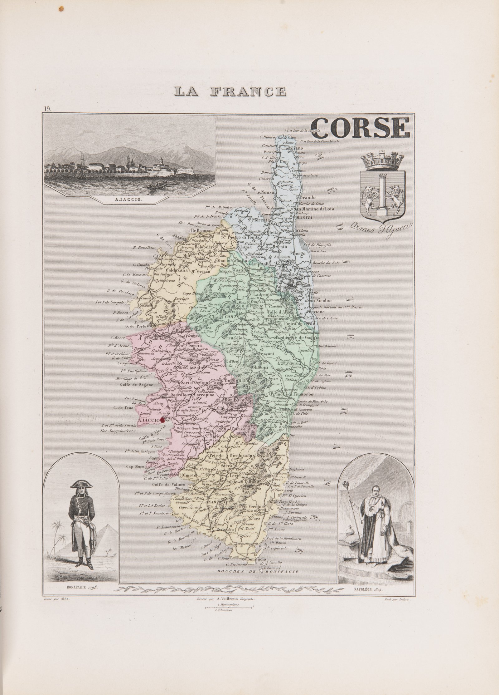
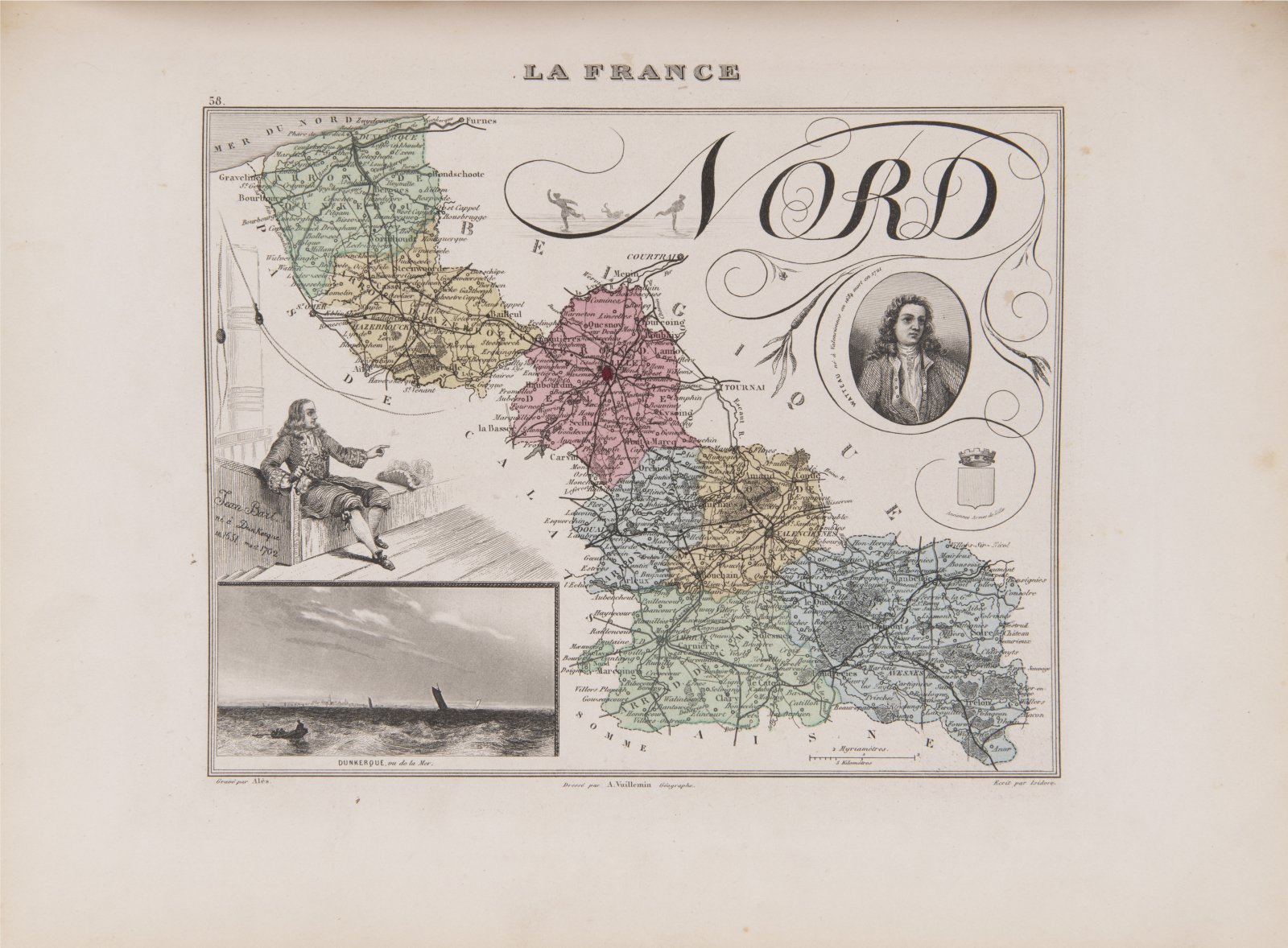
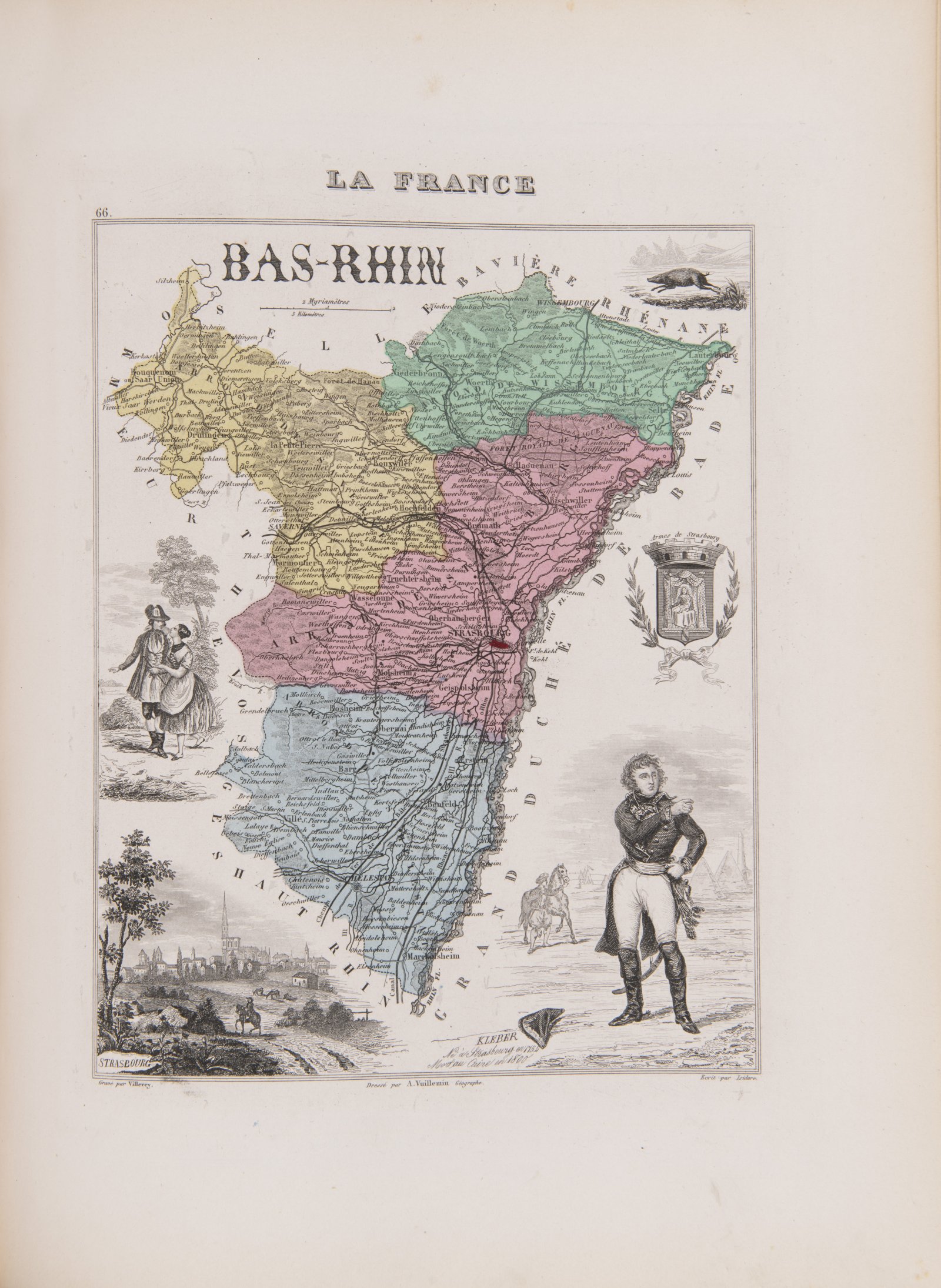
An extensive detailed atlas of France and its colonies is a set of maps of individual departments, colonies and standard geographical descriptions of the area on the opposite board so that the reader has both views available simultaneously and can locate textual information. In addition to the cartographic map, the narrative maps are equipped with other engraved content: heraldry, views, depictions of famous figures of the region with their attributes, or characteristic features of the area (nature, history, crafts, military, church). A book with an engraved title page and a total of 105 colored steel engraving maps.
Andere Auktionsgegenstände

Lot 1 A LATE GOTHIC MADONNA
Rufpreis240 000 CZK | 9 600 EUR
Erzielter Preis
240 000 CZK | 9 600 EUR

Lot 2 PIETA
Rufpreis220 000 CZK | 8 800 EUR
Erzielter Preis
230 000 CZK | 9 200 EUR

Lot 3 PAIRED PICTURES - MOCKING JESUS CHRIST
Rufpreis12 000 CZK | 480 EUR
Erzielter Preis
23 000 CZK | 920 EUR

Lot 4 RESURRECTION OF A CHRIST
Rufpreis17 000 CZK | 680 EUR
Erzielter Preis
30 000 CZK | 1 200 EUR

Lot 5 EARLY ROMAN AND GREEK GEOGRAPHY
Rufpreis24 000 CZK | 960 EUR

Lot 6 FOUR EARLY PRINTS OF ROMAN ANTIQUE CLASSICS
Rufpreis35 000 CZK | 1 400 EUR
Erzielter Preis
35 000 CZK | 1 400 EUR

Lot 7 AMATORIA
Rufpreis18 000 CZK | 720 EUR
Erzielter Preis
18 000 CZK | 720 EUR

Lot 8 PRAGUE RENAISSANCE COSMOGRAPHY
Rufpreis48 000 CZK | 1 920 EUR
Verkauft

Lot 9 ANNUNCIATION
Rufpreis240 000 CZK | 9 600 EUR
Erzielter Preis
240 000 CZK | 9 600 EUR

Lot 10 EVENING LANDSCAPE WITH BRIDGE AND HUNTERS
Rufpreis65 000 CZK | 2 600 EUR
Erzielter Preis
80 000 CZK | 3 200 EUR

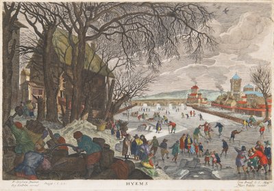
Lot 11 WINTER LANDSCAPE WITH SKATERS
Rufpreis45 000 CZK | 1 800 EUR
Erzielter Preis
85 000 CZK | 3 400 EUR
Lot 12 ALLEGORY OF WINTER
Rufpreis15 000 CZK | 600 EUR
Erzielter Preis
32 000 CZK | 1 280 EUR