
120 000 CZK
| 5 217 EUR
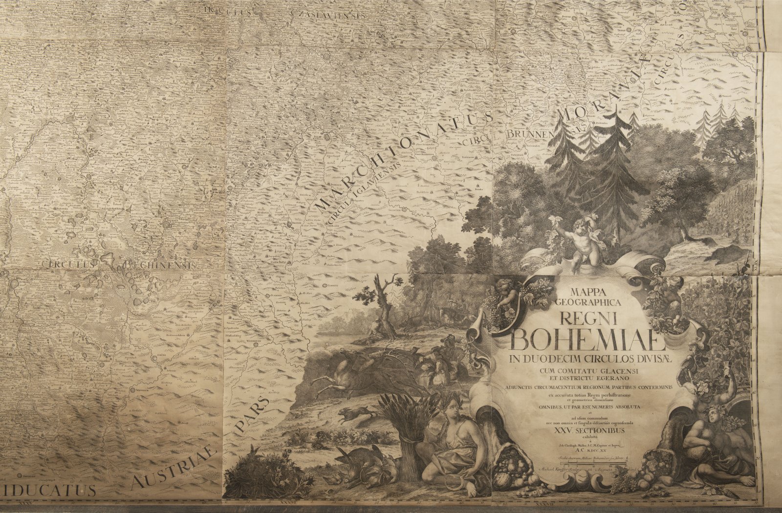
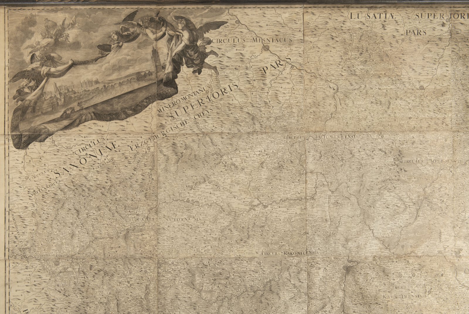
Müller's map of Bohemia is a map by the German cartographer Jan Kryštof Müller from the year depicting Bohemia at a scale of 1: 132,000. It is the largest old map of Bohemia - it has a total of 25 sections. It is also the last and most detailed of Müller's maps (he previously made maps of Hungary and Moravia). Müller began the mapping in 1712 in the Bechyně region and completed it in 1717. He did not live to see the map itself. The relief is shown by the hill method with shading, great attention is paid to the river network, but the greatest interest of the map is a detailed drawing of settlements and economic activities. The map also has quality artistic decoration by Václav Vavřinec Reiner.
Andere Auktionsgegenstände
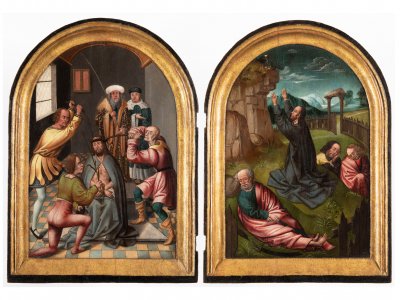
Lot 1 ALTAR WINGS
Rufpreis60 000 CZK | 2 609 EUR
Erzielter Preis
180 000 CZK | 7 826 EUR
Lot 2 MADONNA WITH JESUS AND ST. JOHN THE BAPTIST
Rufpreis800 000 CZK | 34 783 EUR
Erzielter Preis
1 700 000 CZK | 73 913 EUR
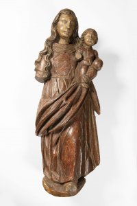
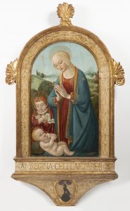
Lot 3 MADONNA WITH CHILD
Rufpreis45 000 CZK | 1 957 EUR
Erzielter Preis
50 000 CZK | 2 174 EUR
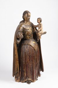
Lot 4 MADONNA WITH A CHILD
Rufpreis45 000 CZK | 1 957 EUR
Erzielter Preis
50 000 CZK | 2 174 EUR
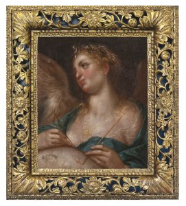
Lot 5 URANIA
Rufpreis180 000 CZK | 7 826 EUR
Erzielter Preis
370 000 CZK | 16 087 EUR
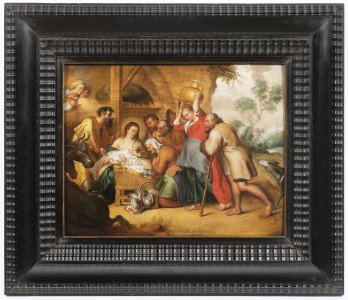
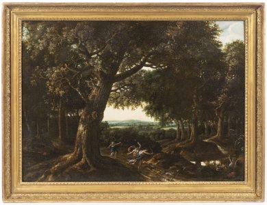
Lot 6 ADORATION OF SHEPHERDS
Rufpreis120 000 CZK | 5 217 EUR
Erzielter Preis
120 000 CZK | 5 217 EUR

Lot 7 ALLEGORY OF AIR
Rufpreis55 000 CZK | 2 391 EUR
Erzielter Preis
110 000 CZK | 4 783 EUR
Lot 8 HUNTING DIANA
Rufpreis55 000 CZK | 2 391 EUR
Erzielter Preis
55 000 CZK | 2 391 EUR
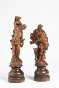
Lot 9 TWO BAROQUE SMALL SCULPTURES
Rufpreis35 000 CZK | 1 522 EUR
Erzielter Preis
70 000 CZK | 3 043 EUR
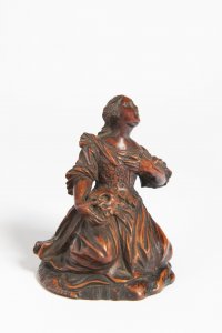
Lot 10 SAINT MARY MAGDALENE
Rufpreis12 000 CZK | 522 EUR
Erzielter Preis
20 000 CZK | 870 EUR
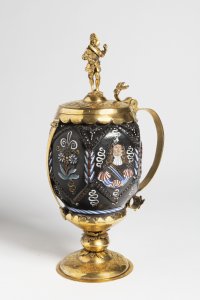
Lot 11 CERAMIC TANKARD IN GILDED MOUNTING
Rufpreis40 000 CZK | 1 739 EUR
Erzielter Preis
42 000 CZK | 1 826 EUR
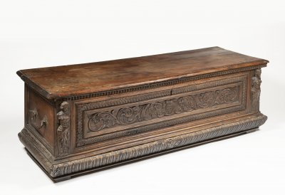
Lot 12 A MANNERIST CHEST
Rufpreis55 000 CZK | 2 391 EUR
Erzielter Preis
70 000 CZK | 3 043 EUR